


Description
The largest earthquake in the world occurred on May 22, 1960, in Chile. Also referred to as the Great Chilean earthquake or the 1960 Valdivia earthquake, the earthquake had a magnitude of 9.5, and according to modern simulation models, generated a powerful Pacific Ocean tsunami that nearly circled the globe. The massive earth movement triggered a number of natural disasters in addition to tsunami, including landslides, a flood, and a volcanic eruption, as well as a seiche on an Argentina lake more than 124 miles away from the epicenter. It was the largest of a series of strong earthquakes that struck the area between May 21st and June 6th of that year. Waves of up to 82 feet wiped out entire areas on the Chilean coast, and reached as far away as Japan and the Philippines.
Given the magnitude of the disaster, the estimated casualties for Chile have wide ranges – between 1655 and 6000 deaths, and $2.9 to 5.8 billion (USD 2011) in damages – which do not differentiate between the earthquakes and the other resulting natural disasters. The current USGS data for areas outside of Chile indicate there were 231 deaths and nearly $950 million in damages.
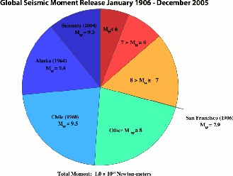
Left: In this chart of global seismic release from 1906 to 2005, almost 25% of the world earthquake energy in a century was concentrated in the 1960 Chile earthquake. (Image: Wikipedia Commons/Richard Aster, New Mexico Tech)
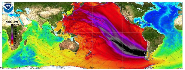
Below: Using historical data, NOAA plotted the maximum amplitude for the tsunami waves generated by the 1960 Chile earthquake. (Image: NOAA Center for Tsunami Research)
Impact
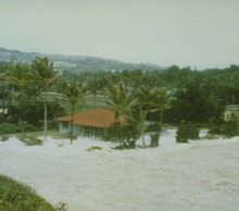
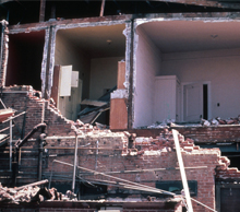
The local tsunamis destroyed many areas of the Chilean coast, and carried remains of houses as far as 2 miles inland. The waves then traveled across the Pacific Ocean and arrived in Hilo, Hawaii, fifteen hours after the earthquake, causing 61 deaths on the waterfront, and causing nearly $57 million (USD 2011) in damages. The west coast of the United States had no deaths, but sustained over $3.7 million in damages.
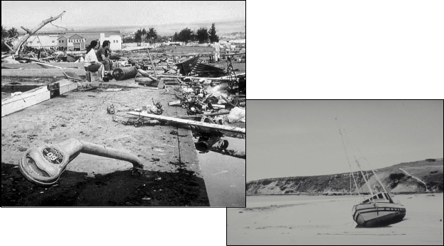
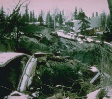
Near right: A couple surveys the damage in Hilo, Hawaii. Note the bent parking meters in the foreground. (Image: USGS)
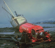
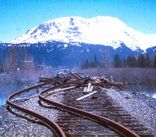
Far right: Beached boat in Crescent City, California. (Image: NOAA/Don Tocher)
Lessons Learned
In spite of the tsunami warning system in place in the Hawaiian Islands, there were numerous fatalities and injuries in Hilo. It appears many of those killed or injured thought the siren was a preliminary warning that would be followed by a second evacuation signal, instead of understanding that it was a signal to evacuate immediately without further notice. Others apparently chose not to evacuate immediately because they did not take the alert seriously after experiencing little or no damage in their experience with previous alerts.
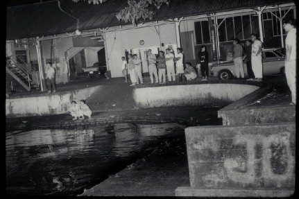
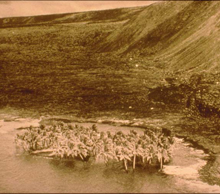
Left: Tsunami waters arrive at the Wailoa River in Hilo as a policeman and curious citizens wait and watch. The tsunami had been predicted to hit at 12 midnight; according to the clock on the wall of the building, this photo was taken at 12:12 a.m. The largest and most damaging third wave had not yet arrived. (Image: NOAA/James Hamasaki)
References and Additional Resources
USGS: Surviving a Tsunami—Lessons from Chile, Hawaii, and Japan
http://pubs.usgs.gov/circ/c1187/
YouTube: Scenes from the aftermath of Chilean earthquake and tsunami
http://www.youtube.com/watch?v=CNZGWw-3pag
University of Washington/Disaster Control Research Center: 1960 Chilean Tsunami
http://www.ess.washington.edu/tsunami/general/historic/chilean60.html
Wikipedia: 1960 Valdivia earthquake
http://en.wikipedia.org/wiki/1960_Valdivia_earthquake
NOAA: Great Chile Earthquake of May 22, 1960 – Anniversary Edition
http://www.ngdc.noaa.gov/nndc/struts/results?eq_1=45&t=101634&s=0&d=4&d=44
USGS Archives: Compilation of casualty and damage estimates.